File:East Cowes Old Road after widening.JPG
Jump to navigation
Jump to search


Size of this preview: 800 × 450 pixels. Other resolutions: 320 × 180 pixels | 640 × 360 pixels | 1,024 × 576 pixels | 1,280 × 720 pixels | 3,712 × 2,088 pixels.
Original file (3,712 × 2,088 pixels, file size: 3.26 MB, MIME type: image/jpeg)
Summary
| Description |
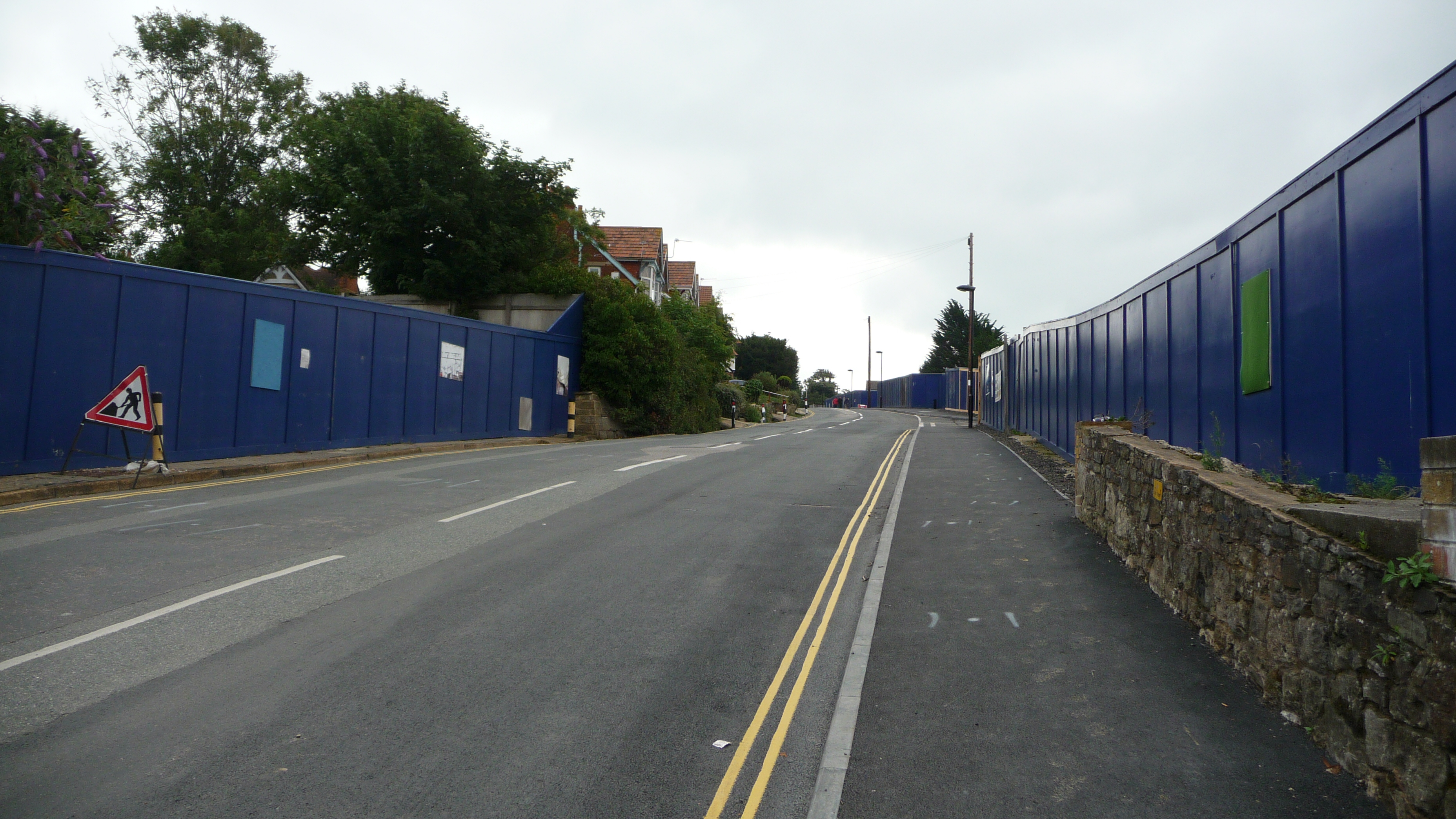
English: Old Road in East Cowes, Isle of Wight. It is seen after it was widened to enable two way traffic flow. Previously, it narrowed so that only one vehicle could go through at a time. This could be done as they are building a new development to the right of the photo, and because the old buildings have been knocked down, there was room for the road to expand. |
| Date | |
| Source | Own work |
| Author | Arriva436 |
| Camera location | | View this and other nearby images on: OpenStreetMap |
|---|
Licensing
I, the copyright holder of this work, hereby publish it under the following licences:
This file is licensed under the Creative Commons Attribution-Share Alike 3.0 Unported licence.
- You are free:
- to share – to copy, distribute and transmit the work
- to remix – to adapt the work
- Under the following conditions:
- attribution – You must give appropriate credit, provide a link to the licence, and indicate if changes were made. You may do so in any reasonable manner, but not in any way that suggests the licensor endorses you or your use.
- share alike – If you remix, transform, or build upon the material, you must distribute your contributions under the same or compatible licence as the original.

|
Permission is granted to copy, distribute and/or modify this document under the terms of the GNU Free Documentation Licence, Version 1.2 or any later version published by the Free Software Foundation; with no Invariant Sections, no Front-Cover Texts, and no Back-Cover Texts. A copy of the licence is included in the section entitled GNU Free Documentation Licence. |
You may select the licence of your choice.
File history
Click on a date/time to view the file as it appeared at that time.
| Date/Time | Thumbnail | Dimensions | User | Comment | |
|---|---|---|---|---|---|
| current | 23:48, 9 February 2010 | | 3,712 × 2,088 (3.26 MB) | Arriva436 | == Summary == {{Information |Description={{en|1=Old Road in East Cowes, Isle of Wight. It is seen after it was widened to enable two way traffic flow. Previously, it narrowed so that only one vehicle could go throu |
File usage
The following page links to this file: