File:Lagskar.jpg
Jump to navigation
Jump to search


Size of this preview: 800 × 533 pixels. Other resolutions: 320 × 213 pixels | 640 × 427 pixels | 1,024 × 683 pixels | 1,500 × 1,000 pixels.
Original file (1,500 × 1,000 pixels, file size: 159 KB, MIME type: image/jpeg)
Summary
| Description |
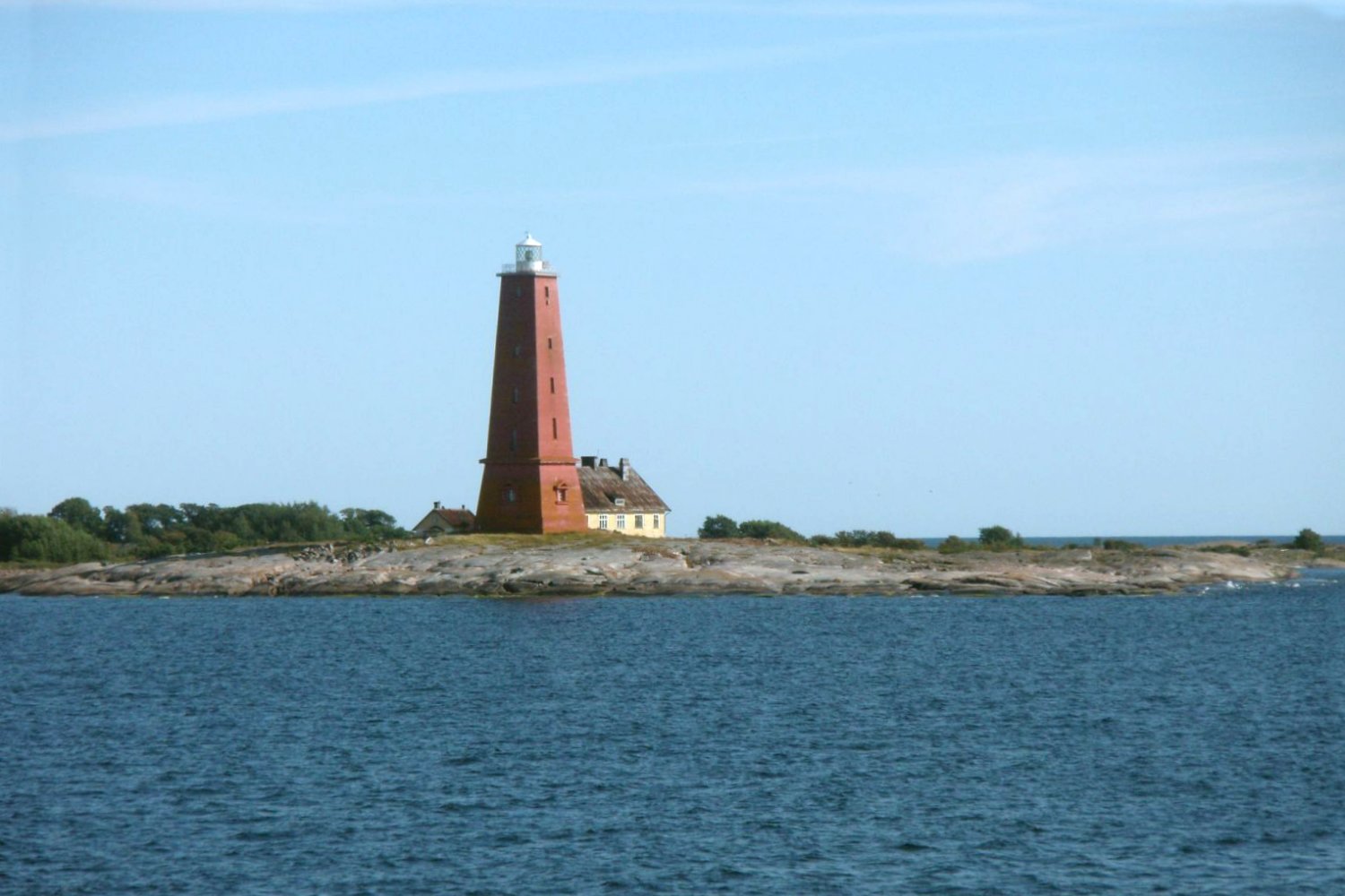
English: Lågskär lighthouse, seen approximately from the west Svenska: Lågskär fyr i norra Östersjön utanför inloppet till Mariehamn Suomi: Lågskärin majakka lännestä nähtynä Español: Faro de Lagskarin Nederlands: Vuurtoren van Lågskär, gezien vanuit het westen |
| Date | |
| Source | Own work |
| Author | Islander |
| Object location | | View this and other nearby images on: OpenStreetMap |
|---|
| Camera location | | View this and other nearby images on: OpenStreetMap |
|---|
Licensing
I, the copyright holder of this work, hereby publish it under the following licences:

|
Permission is granted to copy, distribute and/or modify this document under the terms of the GNU Free Documentation Licence, Version 1.2 or any later version published by the Free Software Foundation; with no Invariant Sections, no Front-Cover Texts, and no Back-Cover Texts. A copy of the licence is included in the section entitled GNU Free Documentation Licence. |
This file is licensed under the Creative Commons Attribution 3.0 Unported licence.
- You are free:
- to share – to copy, distribute and transmit the work
- to remix – to adapt the work
- Under the following conditions:
- attribution – You must give appropriate credit, provide a link to the licence, and indicate if changes were made. You may do so in any reasonable manner, but not in any way that suggests the licensor endorses you or your use.
You may select the licence of your choice.
File history
Click on a date/time to view the file as it appeared at that time.
| Date/Time | Thumbnail | Dimensions | User | Comment | |
|---|---|---|---|---|---|
| current | 11:33, 30 September 2010 | | 1,500 × 1,000 (159 KB) | Esquilo | Rotated and colours adjusted |
File usage
The following page links to this file: