File:Water flows over dam on the Waren Burn at Twizell Mill - geograph.org.uk - 780768.jpg
Jump to navigation
Jump to search


No higher resolution available.
Water_flows_over_dam_on_the_Waren_Burn_at_Twizell_Mill_-_geograph.org.uk_-_780768.jpg (640 × 480 pixels, file size: 95 KB, MIME type: image/jpeg)
Summary
| Description |
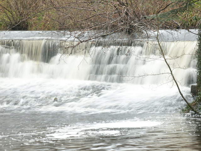
English: Water flows over dam on the Waren Burn at Twizell Mill Built to provide water for nearby sawmill |
| Date | |
| Source | From geograph.org.uk |
| Author | Alfie Tait |
| Attribution (required by the licence) | Alfie Tait / Water flows over dam on the Waren Burn at Twizell Mill / |
| Camera location | | View this and other nearby images on: OpenStreetMap |
|---|
_heading:315.00&language=en-gb)
| Object location | | View this and other nearby images on: OpenStreetMap |
|---|
_heading:315.00&language=en-gb)
Licensing

|
This image was taken from the Geograph project collection. See this photograph's page on the Geograph website for the photographer's contact details. The copyright on this image is owned by Alfie Tait and is licensed for reuse under the Creative Commons Attribution-ShareAlike 2.0 license.
|
This file is licensed under the Creative Commons Attribution-Share Alike 2.0 Generic licence.
Attribution: Alfie Tait
- You are free:
- to share – to copy, distribute and transmit the work
- to remix – to adapt the work
- Under the following conditions:
- attribution – You must give appropriate credit, provide a link to the licence, and indicate if changes were made. You may do so in any reasonable manner, but not in any way that suggests the licensor endorses you or your use.
- share alike – If you remix, transform, or build upon the material, you must distribute your contributions under the same or compatible licence as the original.

|
The categories of this image need checking. You can do so here.
|
File history
Click on a date/time to view the file as it appeared at that time.
| Date/Time | Thumbnail | Dimensions | User | Comment | |
|---|---|---|---|---|---|
| current | 06:03, 20 February 2011 | | 640 × 480 (95 KB) | GeographBot | == {{int:filedesc}} == {{Information |description={{en|1=Water flows over dam on the Waren Burn at Twizell Mill Built to provide water for nearby sawmill}} |date=2008-04-18 |source=From [http://www.geograph.org.uk/photo/780768 geograph.org.uk] |author=[ht |
File usage
The following page links to this file: